| at: |
DeSoto National Forest - South |
Data from USFS GIS
 show on map
 animate
Trail users:


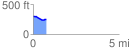
Elevation Profile
 0.787813 mi
 14.24 ft
 70.98 ft
 -56.74 ft
 1.71 %
GPX Downloads: Track Route
![]()
| at: |
DeSoto National Forest - South |
show on map
animate
0.787813 mi
14.24 ft
70.98 ft
-56.74 ft
1.71 %