| at: |
DeSoto National Forest - South |
Data from USFS GIS
 show on map
 animate
Trail users:


Elevation Profile
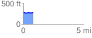
 0.804498 mi
 20.01 ft
 31.97 ft
 -11.96 ft
 0.75 %
GPX Downloads: Track Route
![]()
| at: |
DeSoto National Forest - South |
show on map
animate
0.804498 mi
20.01 ft
31.97 ft
-11.96 ft
0.75 %