| at: |
DeSoto National Forest - South |
Data from USFS GIS
 show on map
 animate
Trail users:


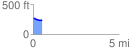
Elevation Profile
 0.514901 mi
 7.84 ft
 39.03 ft
 -31.18 ft
 1.44 %
GPX Downloads: Track Route
![]()
| at: |
DeSoto National Forest - South |
show on map
animate
0.514901 mi
7.84 ft
39.03 ft
-31.18 ft
1.44 %