| at: |
DeSoto National Forest - South |
Data from USFS GIS
 show on map
 animate
Trail users:


Elevation Profile
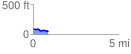
 0.894553 mi
 33.07 ft
 65.16 ft
 -32.09 ft
 1.38 %
GPX Downloads: Track Route
![]()
| at: |
DeSoto National Forest - South |
show on map
animate
0.894553 mi
33.07 ft
65.16 ft
-32.09 ft
1.38 %