|
| at: |
DeSoto National Forest - South |
Data from USFS GIS
 show on map
 animate
Trail users:


Elevation Profile
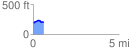
 0.600586 mi
 41.02 ft
 38.45 ft
 2.56 ft
 1.29 %
GPX Downloads: Track Route
![]()
|
| at: |
DeSoto National Forest - South |
show on map
animate
0.600586 mi
41.02 ft
38.45 ft
2.56 ft
1.29 %