| at: |
DeSoto National Forest - South |
Data from USFS GIS
 show on map
 animate
Trail users:


Elevation Profile
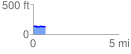
 0.748371 mi
 18.42 ft
 27.05 ft
 -8.63 ft
 0.68 %
GPX Downloads: Track Route
![]()
| at: |
DeSoto National Forest - South |
show on map
animate
0.748371 mi
18.42 ft
27.05 ft
-8.63 ft
0.68 %