| at: |
DeSoto National Forest - South |
Data from USFS GIS
 show on map
 animate
Trail users:


Elevation Profile
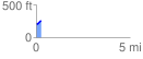
 0.268881 mi
 52.51 ft
 14.42 ft
 38.09 ft
 3.70 %
GPX Downloads: Track Route
![]()
| at: |
DeSoto National Forest - South |
show on map
animate
0.268881 mi
52.51 ft
14.42 ft
38.09 ft
3.70 %