| at: |
Homochitto National Forest |
Data from USFS GIS
 show on map
 animate
Trail users:


Elevation Profile
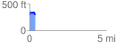
 0.362065 mi
 69.10 ft
 64.25 ft
 4.84 ft
 3.61 %
GPX Downloads: Track Route
![]()
| at: |
Homochitto National Forest |
show on map
animate
0.362065 mi
69.10 ft
64.25 ft
4.84 ft
3.61 %