| at: |
Homochitto National Forest |
Data from USFS GIS
 show on map
 animate
Trail users:


Elevation Profile
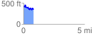
 0.828462 mi
 179.25 ft
 241.74 ft
 -62.48 ft
 5.53 %
GPX Downloads: Track Route
![]()
| at: |
Homochitto National Forest |
show on map
animate
0.828462 mi
179.25 ft
241.74 ft
-62.48 ft
5.53 %