| at: |
Homochitto National Forest |
Data from USFS GIS
 show on map
 animate
Trail users:


Elevation Profile
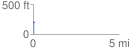
 0.066190 mi
 10.83 ft
 8.87 ft
 1.96 ft
 3.10 %
GPX Downloads: Track Route
![]()
| at: |
Homochitto National Forest |
show on map
animate
0.066190 mi
10.83 ft
8.87 ft
1.96 ft
3.10 %