| at: |
Homochitto National Forest |
Data from USFS GIS
 show on map
 animate
Trail users:


Elevation Profile
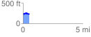
 0.532867 mi
 105.21 ft
 92.29 ft
 12.92 ft
 3.74 %
GPX Downloads: Track Route
![]()
| at: |
Homochitto National Forest |
show on map
animate
0.532867 mi
105.21 ft
92.29 ft
12.92 ft
3.74 %