| at: |
Homochitto National Forest |
Data from USFS GIS
 show on map
 animate
Trail users:


Elevation Profile
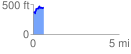
 0.624253 mi
 155.03 ft
 79.55 ft
 75.48 ft
 4.70 %
GPX Downloads: Track Route
![]()
| at: |
Homochitto National Forest |
show on map
animate
0.624253 mi
155.03 ft
79.55 ft
75.48 ft
4.70 %