|
| at: |
Homochitto National Forest |
Data from USFS GIS
 show on map
 animate
Trail users:


Elevation Profile
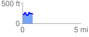
 0.869017 mi
 158.62 ft
 129.97 ft
 28.65 ft
 3.46 %
GPX Downloads: Track Route
![]()
|
| at: |
Homochitto National Forest |
show on map
animate
0.869017 mi
158.62 ft
129.97 ft
28.65 ft
3.46 %