| at: |
Homochitto National Forest |
Data from USFS GIS
 show on map
 animate
Trail users:


Elevation Profile
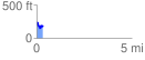
 0.343556 mi
 63.21 ft
 138.53 ft
 -75.32 ft
 7.64 %
GPX Downloads: Track Route
![]()
| at: |
Homochitto National Forest |
show on map
animate
0.343556 mi
63.21 ft
138.53 ft
-75.32 ft
7.64 %