| at: |
Homochitto National Forest |
Data from USFS GIS
 show on map
 animate
Trail users:


Elevation Profile
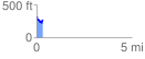
 0.319025 mi
 52.60 ft
 100.74 ft
 -48.14 ft
 5.98 %
GPX Downloads: Track Route
![]()
| at: |
Homochitto National Forest |
show on map
animate
0.319025 mi
52.60 ft
100.74 ft
-48.14 ft
5.98 %