| at: |
Homochitto National Forest |
Data from USFS GIS
 show on map
 animate
Trail users:


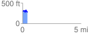
Elevation Profile
 0.423531 mi
 96.01 ft
 104.60 ft
 -8.59 ft
 4.68 %
GPX Downloads: Track Route
![]()
| at: |
Homochitto National Forest |
show on map
animate
0.423531 mi
96.01 ft
104.60 ft
-8.59 ft
4.68 %