| at: |
Homochitto National Forest |
Data from USFS GIS
 show on map
 animate
Trail users:


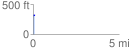
Elevation Profile
 0.064809 mi
 14.77 ft
 6.77 ft
 8.01 ft
 4.32 %
GPX Downloads: Track Route
![]()
| at: |
Homochitto National Forest |
show on map
animate
0.064809 mi
14.77 ft
6.77 ft
8.01 ft
4.32 %