| at: |
Homochitto National Forest |
Data from USFS GIS
 show on map
 animate
Trail users:


Elevation Profile
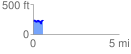
 0.566402 mi
 96.46 ft
 107.01 ft
 -10.56 ft
 3.58 %
GPX Downloads: Track Route
![]()
| at: |
Homochitto National Forest |
show on map
animate
0.566402 mi
96.46 ft
107.01 ft
-10.56 ft
3.58 %