| at: |
Homochitto National Forest |
Data from USFS GIS
 show on map
 animate
Trail users:


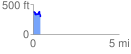
Elevation Profile
 0.431407 mi
 63.77 ft
 148.24 ft
 -84.47 ft
 6.51 %
GPX Downloads: Track Route
![]()
| at: |
Homochitto National Forest |
show on map
animate
0.431407 mi
63.77 ft
148.24 ft
-84.47 ft
6.51 %