| at: |
Homochitto National Forest |
Data from USFS GIS
 show on map
 animate
Trail users:


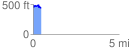
Elevation Profile
 0.468623 mi
 86.89 ft
 86.80 ft
 0.09 ft
 3.51 %
GPX Downloads: Track Route
![]()
| at: |
Homochitto National Forest |
show on map
animate
0.468623 mi
86.89 ft
86.80 ft
0.09 ft
3.51 %