| at: |
Homochitto National Forest |
Data from USFS GIS
 show on map
 animate
Trail users:


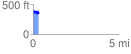
Elevation Profile
 0.330538 mi
 72.83 ft
 122.68 ft
 -49.85 ft
 7.03 %
GPX Downloads: Track Route
![]()
| at: |
Homochitto National Forest |
show on map
animate
0.330538 mi
72.83 ft
122.68 ft
-49.85 ft
7.03 %