| at: |
Homochitto National Forest |
Data from USFS GIS
 show on map
 animate
Trail users:


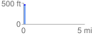
Elevation Profile
 0.154933 mi
 14.59 ft
 1.60 ft
 12.99 ft
 1.78 %
GPX Downloads: Track Route
![]()
| at: |
Homochitto National Forest |
show on map
animate
0.154933 mi
14.59 ft
1.60 ft
12.99 ft
1.78 %