| at: |
Homochitto National Forest |
Data from USFS GIS
 show on map
 animate
Trail users:


Elevation Profile
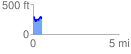
 0.512224 mi
 115.42 ft
 107.94 ft
 7.48 ft
 4.27 %
GPX Downloads: Track Route
![]()
| at: |
Homochitto National Forest |
show on map
animate
0.512224 mi
115.42 ft
107.94 ft
7.48 ft
4.27 %