| at: |
Homochitto National Forest |
Data from USFS GIS
 show on map
 animate
Trail users:


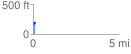
Elevation Profile
 0.132192 mi
 48.26 ft
 20.03 ft
 28.22 ft
 6.91 %
GPX Downloads: Track Route
![]()
| at: |
Homochitto National Forest |
show on map
animate
0.132192 mi
48.26 ft
20.03 ft
28.22 ft
6.91 %