| at: |
Homochitto National Forest |
Data from USFS GIS
 show on map
 animate
Trail users:


Elevation Profile
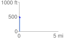
 0.143901 mi
 52.66 ft
 34.92 ft
 17.74 ft
 6.93 %
GPX Downloads: Track Route
![]()
| at: |
Homochitto National Forest |
show on map
animate
0.143901 mi
52.66 ft
34.92 ft
17.74 ft
6.93 %