| at: |
Homochitto National Forest |
Data from USFS GIS
 show on map
 animate
Trail users:


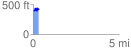
Elevation Profile
 0.349135 mi
 84.42 ft
 82.91 ft
 1.51 ft
 4.58 %
GPX Downloads: Track Route
![]()
| at: |
Homochitto National Forest |
show on map
animate
0.349135 mi
84.42 ft
82.91 ft
1.51 ft
4.58 %