| at: |
Homochitto National Forest |
Data from USFS GIS
 show on map
 animate
Trail users:


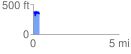
Elevation Profile
 0.353908 mi
 120.95 ft
 146.87 ft
 -25.92 ft
 7.86 %
GPX Downloads: Track Route
![]()
| at: |
Homochitto National Forest |
show on map
animate
0.353908 mi
120.95 ft
146.87 ft
-25.92 ft
7.86 %