| at: |
Homochitto National Forest |
Data from USFS GIS
 show on map
 animate
Trail users:


Elevation Profile
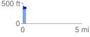
 0.290025 mi
 126.71 ft
 100.62 ft
 26.08 ft
 8.27 %
GPX Downloads: Track Route
![]()
| at: |
Homochitto National Forest |
show on map
animate
0.290025 mi
126.71 ft
100.62 ft
26.08 ft
8.27 %