|
| at: |
Homochitto National Forest |
Data from USFS GIS
 show on map
 animate
Trail users:


Elevation Profile
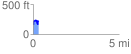
 0.313554 mi
 142.38 ft
 72.97 ft
 69.41 ft
 8.60 %
GPX Downloads: Track Route
![]()
|
| at: |
Homochitto National Forest |
show on map
animate
0.313554 mi
142.38 ft
72.97 ft
69.41 ft
8.60 %