| at: |
Homochitto National Forest |
Data from USFS GIS
 show on map
 animate
Trail users:


Elevation Profile
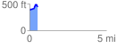
 0.520958 mi
 116.43 ft
 49.61 ft
 66.83 ft
 4.23 %
GPX Downloads: Track Route
![]()
| at: |
Homochitto National Forest |
show on map
animate
0.520958 mi
116.43 ft
49.61 ft
66.83 ft
4.23 %