|
| at: |
Homochitto National Forest |
Data from USFS GIS
 show on map
 animate
Trail users:


Elevation Profile
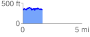
 1.676248 mi
 280.18 ft
 294.21 ft
 -14.03 ft
 3.32 %
GPX Downloads: Track Route
![]()
|
| at: |
Homochitto National Forest |
show on map
animate
1.676248 mi
280.18 ft
294.21 ft
-14.03 ft
3.32 %