|
| at: |
Homochitto National Forest |
Data from USFS GIS
 show on map
 animate
Trail users:


Elevation Profile
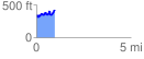
 0.977220 mi
 234.12 ft
 160.93 ft
 73.19 ft
 4.54 %
GPX Downloads: Track Route
![]()
|
| at: |
Homochitto National Forest |
show on map
animate
0.977220 mi
234.12 ft
160.93 ft
73.19 ft
4.54 %