|
| at: |
Homochitto National Forest |
Data from USFS GIS
 show on map
 animate
Trail users:


Elevation Profile
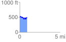
 0.909410 mi
 129.81 ft
 156.45 ft
 -26.64 ft
 3.26 %
GPX Downloads: Track Route
![]()
|
| at: |
Homochitto National Forest |
show on map
animate
0.909410 mi
129.81 ft
156.45 ft
-26.64 ft
3.26 %