| at: |
Homochitto National Forest |
Data from USFS GIS
 show on map
 animate
Trail users:


Elevation Profile
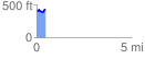
 0.456781 mi
 80.76 ft
 64.94 ft
 15.82 ft
 3.35 %
GPX Downloads: Track Route
![]()
| at: |
Homochitto National Forest |
show on map
animate
0.456781 mi
80.76 ft
64.94 ft
15.82 ft
3.35 %