| at: |
Homochitto National Forest |
Data from USFS GIS
 show on map
 animate
Trail users:


Elevation Profile
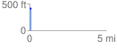
 0.100450 mi
 25.68 ft
 10.28 ft
 15.40 ft
 4.84 %
GPX Downloads: Track Route
![]()
| at: |
Homochitto National Forest |
show on map
animate
0.100450 mi
25.68 ft
10.28 ft
15.40 ft
4.84 %