| at: |
Homochitto National Forest |
Data from USFS GIS
 show on map
 animate
Trail users:


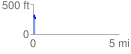
Elevation Profile
 0.140101 mi
 10.13 ft
 67.68 ft
 -57.55 ft
 9.15 %
GPX Downloads: Track Route
![]()
| at: |
Homochitto National Forest |
show on map
animate
0.140101 mi
10.13 ft
67.68 ft
-57.55 ft
9.15 %