| at: |
Homochitto National Forest |
Data from USFS GIS
 show on map
 animate
Trail users:


Elevation Profile
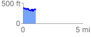
 1.125988 mi
 229.47 ft
 259.85 ft
 -30.37 ft
 4.37 %
GPX Downloads: Track Route
![]()
| at: |
Homochitto National Forest |
show on map
animate
1.125988 mi
229.47 ft
259.85 ft
-30.37 ft
4.37 %