| at: |
Homochitto National Forest |
Data from USFS GIS
 show on map
 animate
Trail users:


Elevation Profile
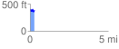
 0.273280 mi
 73.71 ft
 69.16 ft
 4.54 ft
 5.11 %
GPX Downloads: Track Route
![]()
| at: |
Homochitto National Forest |
show on map
animate
0.273280 mi
73.71 ft
69.16 ft
4.54 ft
5.11 %