| at: |
Homochitto National Forest |
Data from USFS GIS
 show on map
 animate
Trail users:


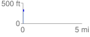
Elevation Profile
 0.081312 mi
 19.14 ft
 41.81 ft
 -22.67 ft
 9.74 %
GPX Downloads: Track Route
![]()
| at: |
Homochitto National Forest |
show on map
animate
0.081312 mi
19.14 ft
41.81 ft
-22.67 ft
9.74 %