| at: |
Homochitto National Forest |
Data from USFS GIS
 show on map
 animate
Trail users:


Elevation Profile
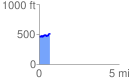
 0.665101 mi
 135.23 ft
 84.87 ft
 50.36 ft
 3.85 %
GPX Downloads: Track Route
![]()
| at: |
Homochitto National Forest |
show on map
animate
0.665101 mi
135.23 ft
84.87 ft
50.36 ft
3.85 %