| at: |
Homochitto National Forest |
Data from USFS GIS
 show on map
 animate
Trail users:


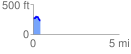
Elevation Profile
 0.419463 mi
 44.16 ft
 100.15 ft
 -55.99 ft
 4.52 %
GPX Downloads: Track Route
![]()
| at: |
Homochitto National Forest |
show on map
animate
0.419463 mi
44.16 ft
100.15 ft
-55.99 ft
4.52 %