| at: |
Homochitto National Forest |
Data from USFS GIS
 show on map
 animate
Trail users:


Elevation Profile
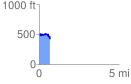
 0.696260 mi
 149.95 ft
 175.17 ft
 -25.22 ft
 4.76 %
GPX Downloads: Track Route
![]()
| at: |
Homochitto National Forest |
show on map
animate
0.696260 mi
149.95 ft
175.17 ft
-25.22 ft
4.76 %