| at: |
Homochitto National Forest |
Data from USFS GIS
 show on map
 animate
Trail users:


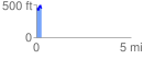
Elevation Profile
 0.267989 mi
 69.26 ft
 60.87 ft
 8.39 ft
 4.89 %
GPX Downloads: Track Route
![]()
| at: |
Homochitto National Forest |
show on map
animate
0.267989 mi
69.26 ft
60.87 ft
8.39 ft
4.89 %