| at: |
Homochitto National Forest |
Data from USFS GIS
 show on map
 animate
Trail users:


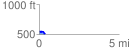
Elevation Profile
 0.368598 mi
 27.61 ft
 59.90 ft
 -32.29 ft
 3.08 %
GPX Downloads: Track Route
![]()
| at: |
Homochitto National Forest |
show on map
animate
0.368598 mi
27.61 ft
59.90 ft
-32.29 ft
3.08 %