| at: |
Kisatchie National Forest - Caney District |
Data from USFS GIS
 show on map
 animate
Trail users:


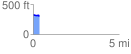
Elevation Profile
 0.374644 mi
 2.93 ft
 32.60 ft
 -29.67 ft
 1.65 %
GPX Downloads: Track Route
![]()
| at: |
Kisatchie National Forest - Caney District |
show on map
animate
0.374644 mi
2.93 ft
32.60 ft
-29.67 ft
1.65 %