| at: |
Coleman River Scenic Area |
Data from David Muse
 show on map
 animate
Trail users:


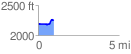
Elevation Profile
 0.959352 mi
 105.52 ft
 32.93 ft
 72.59 ft
 2.08 %
GPX Downloads: Track Route
![]()
| at: |
Coleman River Scenic Area |
show on map
animate
0.959352 mi
105.52 ft
32.93 ft
72.59 ft
2.08 %