| at: |
Kisatchie National Forest - Kisatchie District |
Data from USFS GIS
 show on map
 animate
Trail users:


Elevation Profile
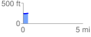
 0.421400 mi
 10.30 ft
 20.75 ft
 -10.45 ft
 0.93 %
GPX Downloads: Track Route
![]()
| at: |
Kisatchie National Forest - Kisatchie District |
show on map
animate
0.421400 mi
10.30 ft
20.75 ft
-10.45 ft
0.93 %