|
| at: |
Kisatchie National Forest - Kisatchie District |
Data from USFS GIS
 show on map
 animate
Trail users:


Elevation Profile
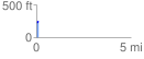
 0.104973 mi
 16.85 ft
 4.59 ft
 12.26 ft
 3.04 %
GPX Downloads: Track Route
![]()
|
| at: |
Kisatchie National Forest - Kisatchie District |
show on map
animate
0.104973 mi
16.85 ft
4.59 ft
12.26 ft
3.04 %