| at: |
Fort Mountain State Park Area |
Data from David Muse
 show on map
 animate
Trail users:


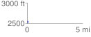
Elevation Profile
 0.050269 mi
 0.18 ft
 34.54 ft
 -34.36 ft
 13.01 %
GPX Downloads: Track Route
![]()
| at: |
Fort Mountain State Park Area |
show on map
animate
0.050269 mi
0.18 ft
34.54 ft
-34.36 ft
13.01 %