| at: |
Sumter National Forest - Enoree District |
Data from USFS GIS
 show on map
 animate
Trail users:


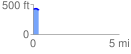
Elevation Profile
 0.333051 mi
 12.17 ft
 34.32 ft
 -22.14 ft
 1.95 %
GPX Downloads: Track Route
![]()
| at: |
Sumter National Forest - Enoree District |
show on map
animate
0.333051 mi
12.17 ft
34.32 ft
-22.14 ft
1.95 %